Civil Engineering Resources
GIS for Civil Engineering
Introductory GIS for 1st year Civil Engineering Students
Content Preview
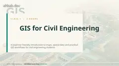
C L A S S 1 | 2 H O U R S GIS for Civil Engineering A beginner friendly introduction to maps, spatial data and practical GIS workflows for civil engineering students GIS for Civil Engineering | Md Ahbab Hamid Khan ahbab.dev 1
Plan for today 2 HOUR CLASS GIS for Civil Engineering | Md Ahbab Hamid Khan ahbab.dev 2 Time What we cover 0:00 - 0:20 What GIS is, history, why it matters 0:20 - 0:45 Spatial data: vector, raster, layers, attributes 0:45 - 1:05 Coordinate systems and map projections 1:05 - 1:25 QGIS practical workflow 1:25 - 1:50 Analysis and civil engineering applications 1:50 - 2:00 Mini project, mistakes, what comes next Short practice exercises follow each major part. Try them later with the free QGIS software.
What you will be able to do LEARNING OUTCOMES GIS for Civil Engineering | Md Ahbab Hamid Khan ahbab.dev 3 Read spatial data Tell the difference between vector and raster data and know when to use each. Use coordinates Pick the correct coordinate system and avoid layers that do not line up. Work in QGIS Build a project, add layers, query attributes, style and label a map. Analyse a site Use buffer, clip, overlay and slope tools to answer a design question. Make a real map Produce a clean map sheet with title, legend, scale bar and north arrow. Avoid mistakes Spot common data quality and projection errors before they cost money.